
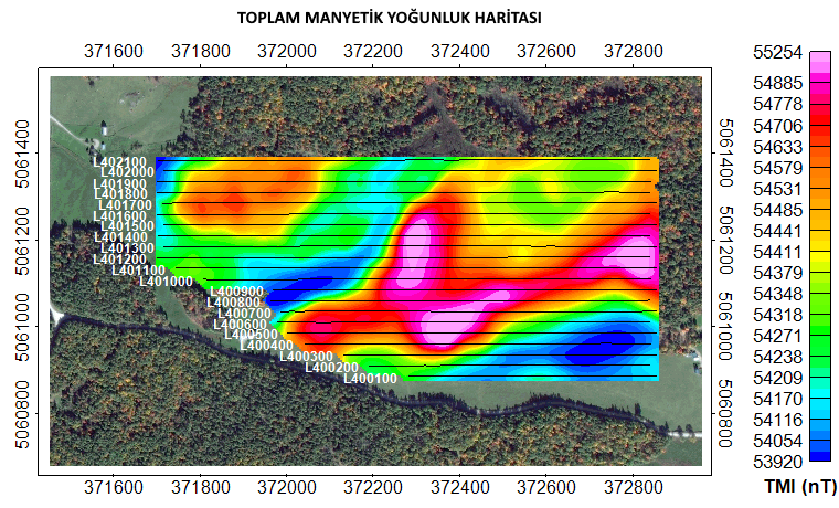
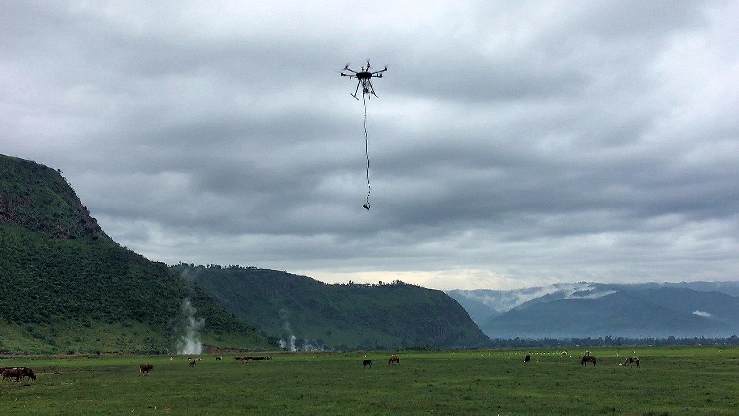
Drone Based Magnetometer System
We provide high resolution data for Drone Based Magnetometer systems, magnetometer surveys projects.
Magnetometers can very easily detect land mines, metallic mine exploration, buried pipe, cable infrastructure, magnetic materials at archaeological sites and unexploded ordnance.
Recent developments in UAV technology have made it even more applicable with longer flight times, precision navigation systems integration and payload capabilities. The advantage of Drone Magnetometers is that we obtain higher resolution data that is safer, more efficient and cost-effective compared to traditional terrestrial handheld scanning and manned aircraft systems.
By integrating UAV, GPS and magnetometer data, we can easily create georeferenced maps.
Why should I prefer Drone Magnetic Surveys?

APPLICATION AREAS
- Mineral deposit exploration
- Pipeline detection
- Embedded infrastructure
- Unexploded ordnance detection (UXO)
- Engineering projects
- Environmental projects
- Archaeology
SOLUTIONS
- Turnkey projects
- Free consultation
- On-call support and service
- Fastest result
- International service area