

From the ancient wonders of the world to the modern buildings we live in today, survey technology has been helping us take measurements for thousands of years. We’ve come a long way from the rope stretchers of ancient Egypt, but land surveying technology is still evolving. Like any industry, the future of land surveying will change in the coming years. Between the increase in drone use, improvements in mobile 3D mapping and changes in data management, there are many developments ahead for surveying. The trends have implications for the industry that could improve data collection, change approaches to data storage and offer more accessible and flexible information collection.
USE OF DRONES
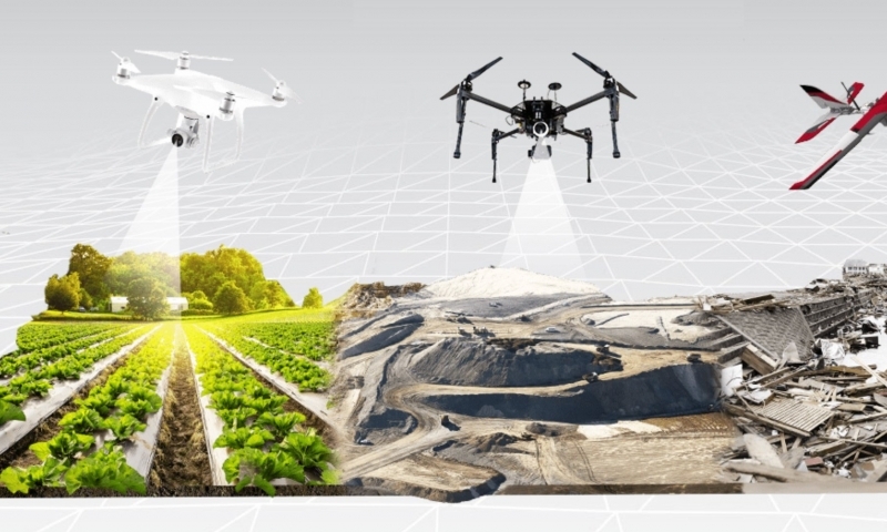
Unmanned aerial vehicles (UAVs) have become increasingly accessible and affordable, making them a great convenience to a researcher. Before their widespread availability, they were considered cost prohibitive for most applications and were reserved for military use. Now, they offer several advantages over both terrestrial survey teams and manned aircraft. Drones can:
- Scan large surface areas in a short time
- Overcome difficult terrain obstacles
- Capture detailed images of hard-to-reach terrain
- Perform land surveys, photogrammetry, 3D mapping, topographic survey and more
Traditional methods were often unable to complete these tasks, whether due to the complex terrain or the sheer amount of time ground-based approaches would take. Surveyors and geoscientists can now get aerial data quickly and accurately with modern drones. UAVs also make the job safer, so drone operators do not need to fly or enter dangerous environments to take measurements. Drones are becoming standard, especially a necessary component of mapping, mineral exploration and landscaping work. It seems that using them will soon become an industry standard.
Drones are also frequently used for cadastre, opening up an important area of use. In addition, they can provide data that integrates with computer-aided design (CAD) software to create models for land development and management. Another benefit of drone use is that they can provide a variety of photos to record land data and structures.
Some other types of data you can collect from drones include:
- 2D Orthomosaic Maps: Combine photos from a drone to create a top-down aerial view.
- 3D Orthomosaic Maps: Combine images to compile a 3D bird’s eye view of an area.
- 3D Models: Create detailed models from powerful mapping software.
- Thermal Maps: Record and identify anomalous heat signatures in an area.
- LiDAR Point Clouds: We’ll talk more about LiDAR in the next section, but drones can help you create a high-density point cloud for use with this system.
- Multispectral Maps: Data outside the visible light spectrum can offer a variety of uses, including missile detection and satellite imaging.
- Building Information Modeling (BIM): Combine high-resolution 3D programmatic or laser models with pre-prepared BIM objects. This information can help identify variations and respond accordingly.
When it comes to achieving the highest possible accuracy, drones can use additional tools such as real-time kinematic (RTK) and post-process kinematic (PPK) positioning. Both are positioning techniques that can improve the precision of data by utilizing information from satellite-based systems.